Joint Terminal Attack Controllers (JTAC) are troops who direct combat aircraft, helicopters or Unmanned Aerial Vehicles engaged in close air support. Previously known as Forward Air Controllers (FAC), their role today is often part of the Joint Fire Support Team (JFST) as they also make use of indirect fire weapons (artillery and mortars) and ship-borne fire.
FACs, JTACs, JFSTs or even Special Operating Forces JTACs (SOJTAC) – they all have the same mission and very similar equipment. Their mission is to provide the fighting force with support fire. A distinction is made between vehicle-mounted – on the KMW FENNEK – remote (dismounted operation and recourse to vehicle support) and fully dismounted JTACs, as the latter must use much more compact and lighter equipment. The JTACs/JFSTs are equipped with a wide-range of communication, observation and reconnaissance tools for carrying out their diverse tasks.
Germany: Project JFST Dismounted
The German Army is currently carrying out a JFST dismounted (JFSTabges) project. The JFST dismounted equipment sets to be procured comprise one air/ground and one ground/ground team each, which are equipped identically. Their capabilities are thus exactly the same as those of the FENNEK-based teams.
The technical system concept ‘JFSTabges’ is divided into different sub-components of target reconnaissance, navigation, IT equipment dismounted operation, communication and endurance capability. The resulting system components are interconnected by a central interface system and energy supply management. In the team, target reconnaissance consists of the primary optical and secondary optical reconnaissance means (daylight, residual light and thermal imager), the gyro and goniometre unit, the laser target designator, the IR target marker and two AN/PSN-13 Defence Advanced GPS Receivers (DAGR) for external self-positioning (Global Navigation Satellite System; GNSS). The modular and scalable equipment can be individually assembled depending on the mission. The necessary energy is provided through two SFC JENNY fuel cells and solar panels.
The complete equipment must not only result in a system, but must be transportable over a long period of time and long distances by two to six soldiers in infantry operations. The first systems are scheduled for field tests in 2021 and will be used for the first time in the NATO Very High Readiness Joint Task Force (VJTF) in 2023. Initially, 83 systems are planned, but 109 will be needed to be fully equipped.
Observation and
Reconnaissance Equipment
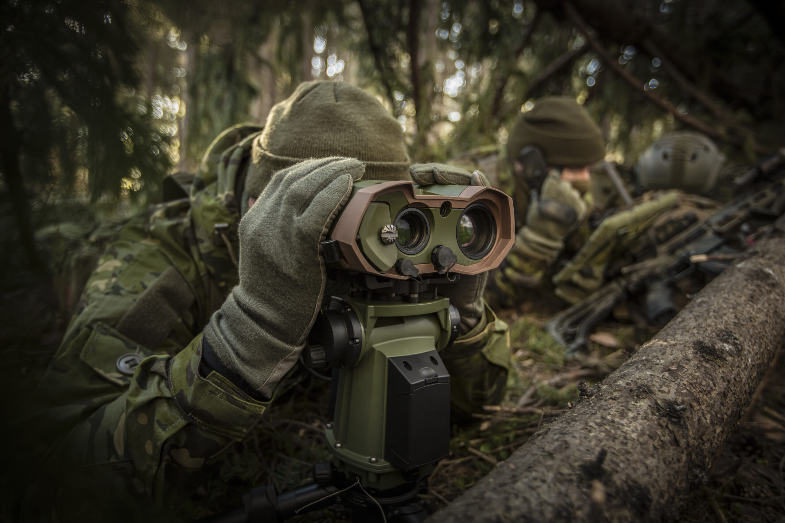
A JTAC must be able to reconnoitre and identify its targets, sometimes over very long distances and capable of determining the position very precisely for the guided weapons to be employed. Long-range sensors are therefore necessary for this purpose.
The primary electro-optical reconnaissance equipment includes day and night channels, thermal imaging scopes and often secondary reconnaissance equipment such as a purely optical glass channel as back-up. To produce the high level of accuracy required, they are fixed on a gyro and goniometre unit – such as the STERNA from Safran Vectronix. Suitable reconnaissance sensors include systems such as JIM LR, MOSKITO TI+, VECTOR (all from Safran), NYXUS BIRD from Jenoptik or the Long View CR/SW from Elbit Systems.
As with observation equipment, there is a wide range of Laser Target Designators (LTD) available on the market. For example, the Type 163 LTD from Leonardo, RATTLER G/H from Elbit Systems, L3Harris SCARAB, DHY308 LW from CILAS, HAMMER from BAE Systems, AN/PEQ-1C from Northrop Grumman, LF28A or TYR from Thales.
Thus, the RATTLER G (1.55 kg) and RATTLER H (1.3 kg) are the lightest systems, but they also offer relatively little energy. The type 163 LTD from Leonardo can be considered something like NATO’s standard LTD. So far, 750+ have been delivered to 23+ NATO countries. It has a size of only 2 litres and a weight of less than 2.5 kg. In terms of power, it offers up to 80 mJ and up to 10+ km range. Since 2020, a DMC (Digital Magnetic Compass) was integrated to display laser to target line and compass heading. SCARAB, with 80-120 mJ offers the most energy.
It is important to understand that more energy ensures greater detectability of the laser spot at greater distances. At the same time, it means more distance to the target and thus more tactical flexibility, accuracy for weapon use and operator safety. Attenuation due to atmospheric disturbances (fog, rain, snow) can also be compensated by high energy lasers. Another factor is laser divergence, meaning the diametre of the laser spot on the target, which should ideally be one metre at a target distance of 5 km.
The reconnaissance equipment or LTD is supplemented by a so-called SeeSpot Device. This enables a laser spot of an LTD to be seen and displayed with the correct laser repetition frequency (Pulse Repetition Frequency), the so-called “laser code”, even in normal daylight and in very bright sunlight. There are commercially available systems with various magnifications and as attachments for other optics. The LTD TAR from Thales and DHY306 LW from CILAS already have SeeSpot permanently integrated. The type 163 can also integrate SeeSpot data, so the user has all relevant data in one system. In addition, the Type 163 LTD is optimised for use with the guided VULCANO artillery ammunition with SAL Seeker.
Laser target illuminators and pointers such as the IZLID ULTRA from B.E. Meyers are significantly smaller. It has a wavelength of 860 nanometres (nm) and thus operates in the Near Infrared Range (NIR). The ULTRA is the successor of the IZLID 1000P, but is more compact (22.8×4.3×4.6 cm) and lighter (332 g with two 3V CR123A batteries). The output power is 1 W. This allows targets to be marked at distances of up to 43 km. For area-wide illumination, the laser then reaches up to 7 km (12 mrad). Different versions are offered, as a hand-held solution and adaptable on a Picatinny rail. In addition, there are versions with other wavelengths such as 1,064 nm or 1,550 nm (Ultra Short Wave Infrared; SWIR).
The UK’s JTACs recently received a new target location and observation system for dismounted operations. At the heart of the system is Elbit Systems’ HattoriX, which was first unveiled publicly in late 2018. It is in use by the Israeli Defence Forces and, according to reports from the company, has recently undergone successful testing by a number of armed forces in Europe and by NATO member countries. The system’s unique selling point is its ability to passively and rapidly detect Category 1 target data (target location error <6 m). HattoriX can be combined with any electro-optical system to form a target location and observation device and consists of a goniometer, a mission computer, a touch-screen display unit and a lightweight tripod. It is a passive/active target acquisition system to enable forward artillery/infantry observers and soldiers with similar tactical missions to provide direct fire support in a few steps and within a very short time and to transmit all target information to effectors. Passive targeting is achieved by data fusion of terrain data from a Geographical Information System (GIS) database with preloaded target data, the system’s visual feed and C2 information. For this purpose, the system combines photogrammetry algorithms and an augmented reality (AR) overlay. This allows Category 1 data to be generated without the use of active emitters (laser rangefinders) that can be detected by enemy reconnaissance systems, and seamlessly transferred to any command and control information system as well as the weapon’s engagement system.
These systems are complemented by the DAGR (Defence Advanced GPS Receiver) equipment, a mobile-held military GPS device that has appropriate encryption/coding and generates military coordinates. The DAGR was launched in 2004 and is manufactured by Rockwell Collins. According to the manufacturer, it operates on the L1 and L2 frequency bands, can be ready for operation within 100 seconds (from a cold start) and is specially protected against jamming (Selective Availability Anti-Spoofing Module (SAASM); 41 dB). It weighs 430 g and the four batteries allow for 14 hours of operation.
Communication
In addition to reconnaissance, communication is particularly important. Since support weapons (aircraft, artillery, ships) are often provided multi-nationally, the JTAC must also be able to communicate with them all. Purely national solutions are therefore out of the question.
Since Close Air Support is mainly provided by US forces, the L3Harris radios are also the standard within NATO, primarily the AN/PRC-117F/G. More functionalities are offered by the L3Harris AN/PRC-158, as well as the AN/PRC-163. Already, the single channel radio L3Harris PRC-117G (Falcon III) offers NATO SATURN as a powerful and introduced (STANAG) Ground-Air-Ground waveform. In the frequency range from 30MHz to 2GHz, various transmission methods are also possible, such as the MANET waveform ANW2C. The PRC-158 (FALCON IV) complements the 117G. Here, two radio channels, extended up to 2.5 GHz, can be found in almost the same volume. The unit is only 300 g heavier than the PRC-117G at 3.7 kg (5.4 kg including battery). But Rohde & Schwarz with the SOVERON family, Elbit Systems with E-LynX or Thales also offer corresponding radios.
In order to become even faster, safer and better, the Persistent Close Air Support (PCAS) project is being developed by the Defense Advanced Research Projects Agency (DARPA) in the US. It offers real-time information exchange, faster response and precise targeting. Instead of voice transmission, digital target information is sent. This saves an enormous amount of time and leads to fewer errors and greater accuracy. It also reduces the pilot’s workload. According to Raytheon, a PCAS-enabled soldier can request air support for multiple targets from manned or unmanned platforms in less than six minutes. Voice requests, on the other hand, can take up to 30 minutes to plan and coordinate.
The PCAS network shares all information digitally between JTACs, pilots and other connected soldiers, via tablets running the Tactical Assault Kit software. The PCAS algorithms in the aircraft help locate targets, map attack routes and deploy the right weapon at the right time for a given target.
This article originally appeared in the July issue of European Security & Defence. Click here to download the full issue in PDF format.


