Introduction
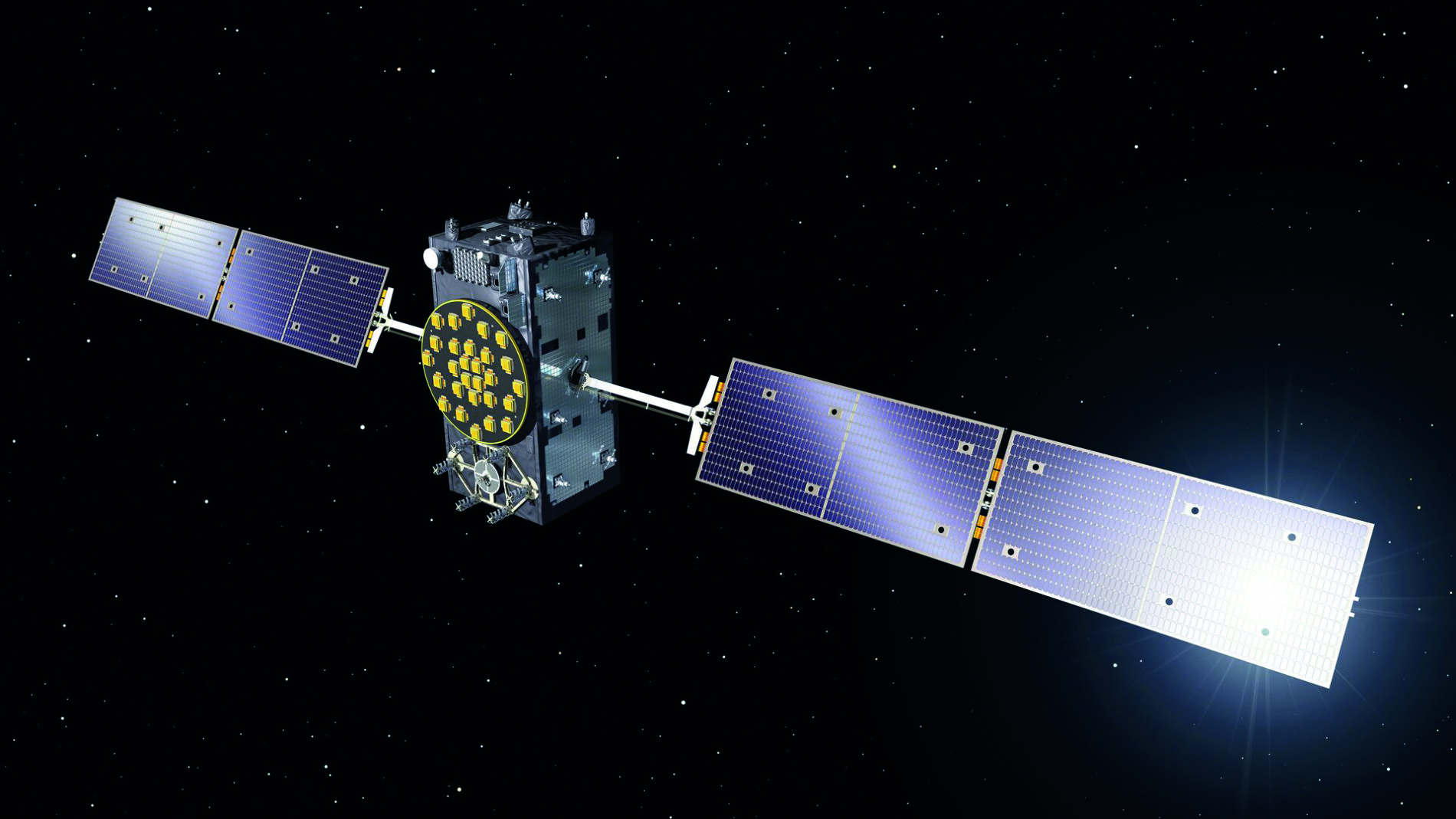
Not since its introduction in 1995 has there been so much focus on the integrity of the US Global Positioning System (GPS). GPS is one of several Global Navigation Satellite Systems (GNSSs). Others include the European Union’s (EU’s) Galileo, the People’s Republic of China’s (PRC’s) Beidou and Russia’s GLONASS. GNSS has become essential for navigation over the past three decades. Aircraft, ships and vehicles all use GNSS to navigate.
The US GPS constellation started life as a Department of Defence (DoD) project. As a result, US and allied militaries rely heavily on GPS technology. As a US government website discussing GPS explains “nearly all new military assets, from vehicles to munitions, come equipped with GPS.”
GPS technology came to public prominence during the 1991 Persian Gulf War. As a US Air Force (USAF) discussion of GNSS during that conflict noted, the Navstar GPS constellation was in its infancy. 19 of the satellites were in orbit and the system was still four years from being declared fully operational. Operation DESERT STORM, the codename for the US-led coalition effort to evict Iraq from Kuwait, was the first conflict where GNSS was routinely used. Navstar aided precision bombing, artillery, ground forces manoeuvre, Special Forces, and combat search and rescue missions during the war. 30 years later, the US and her allies have a total reliance on GPS.
GNSS Jamming
This is not lost on near-peer adversaries like Russia. As Rear Admiral (retired) Nick Lambert, co-founding director of NLA International notes, GNSS is a single point of failure. This is especially relevant in the civilian world. The vulnerability was underlined in the UK Government’s 2018 Satellite-Derived Time and Position, a Study of Critical Dependencies report. A myriad of business models and applications rely on the technology. From global logistics and telecommunications deliveries to stock market trades and even sports and exercise. Our global economy, people and organisations rely on GNSS for Position Navigation and Timing (PNT).
Alongside technology like laser targeting, GPS makes sure that weapons arrive on target, and units and platforms are where they should be. The Russian military took an important lesson. If they could disrupt GPS, they could disrupt the precision and tempo of US and NATO (North Atlantic Treaty Organisation) operations. The Russian Army has begun fielding GNSS jamming systems with its army Electronic Warfare (EW) units. These include the KRET RB-341V Leer-3 EW ensemble. This targets GNSS signals across wavebands of 1.1 gigahertz/GHz to 1.6GHz. The IL269 KARSUKHA-2 electronic attack system covers wavebands of one to two gigahertz. It may also have some utility against GNSS transmissions.
M-Code
The integrity of military GPS signals is protected using M-Code. M-Code is an encrypted GPS signal only accessible by GPS-dependent End-User Devices (EUDs) which can decrypt the signal. M-Code signals are transmitted from satellites at higher power levels making them harder to jam. This gives US and NATO militaries some protection against GPS interference, real or unintentional. Nonetheless, what about non-military users dependent on GPS, or other GNSSs but without access to secure signals? Civilian users have routinely experienced GNSS jamming in the Baltic and eastern Mediterranean, and the South China Sea. The first two instances have been blamed on Russia. The country is believed to have deployed GNSS jammers to its base in northern Syria. The People’s Republic of China has been accused of GNSS jamming in the South China Sea.
Take the civilian shipping sector as an example. The European Space Agency (ESA) funded Maritime Resilience and Integrity of Navigation (MARINAV) project primed by NLA International delivered its findings in March 2020. As noted in the UK government’s 2018 report, the MARINAV project stated that the volume of sea-borne trade is expected to double by 2030: “GPS has become the primary marine aid-to-navigation and source of PNT information.”
Drawbacks
At the same time, GNSSs are vulnerable to natural and deliberate interference. Taking the civilian GPS signal as an example it is easy to see why. The GPS satellites transmit a signal with 44.8 Watts of power. These signals have a long way to travel. GPS satellites orbit at an altitude of around 10,907 nautical miles/nm (20,200 kilometres/km). By the time the signals reach Earth they are very weak. This makes them easy to jam with relatively little power. It also leaves them prey to naturally occurring meteorological phenomena and terrain or building obstructions. These can degrade or block the signal.
The MARINAV project initially focused on the United Kingdom’s maritime critical national infrastructure. It looked at providing “resilient high-integrity PNT for ships and ports.” MARINAV examined mainly terrestrial PNT technologies beyond GNSS. They needed to be capable of providing a ten metre/m (33 feet/ft) positional accuracy for ships approaching port. Their overall accuracy was required to be 20m (66ft). The PNT technologies were examined for possible use in the UK and Ireland’s Exclusive Economic Zones (EEZs). One candidate technology examined by MARINAV was Enhanced Long-Range Navigation, better known as eLoran. As its name suggests, eLoran is a descendant of the erstwhile LORAN navigation system.
LORAN
LORAN was a radio navigation system developed by the United States during the Second World War. It exploited the fact that radio waves travel at the speed of light, 161,595 nautical miles-per-second (299,274 kilometres-per-second). LORAN was primarily used for air and maritime navigation. It used shore-based transmitters. These transmitted a single radio pulse on a frequencies of 90 kilohertz/KHz to 110KHz every half second. Each LORAN station had two transmitters separated from one another.
Let us suppose we have a LORAN station with two transmitters positioned north and south of each other. They are separated by ten nautical miles (18.5km). If a ship with a LORAN receiver is positioned at the exact midpoint between the two transmitters, the half-second pulses from each transmitter will be received at the same time. The pulses from both transmitters will be in phase. If the ship is nearer the northern transmitter, the pulses will be out of phase. Pulses from the northern transmitter will reach the ship’s LORAN receiver slightly quicker than those from the southern transmitter.
By calculating the time lag between the northern and southern pulses, the ship can calculate its position relative to each transmitter. Given that the distance between the two transmitters (ten nautical miles) is known, all that is needed is a little trigonometry to show the ship’s location. The ship is where the two axes from the northern and southern transmitters meet.
Ironically, GNSS killed LORAN. As it became ubiquitous from the 1990s LORAN was gradually replaced. By the late 2000s it was largely phased out. Much as vinyl records have enjoyed a renaissance among hipsters, so LORAN is enjoying a new lease of life. Like today’s records which are hugely improved from the discs of yore, eLoran is a substantial improvement on its ancestor.
eLoran
ELoran uses the same frequencies as LORAN, but that is where the similarity ends. A standard eLoran ensemble covering a specific area will use three transmitters a set distance apart. All three broadcast eight radio pulses, each with one millisecond of spacing. All these pulses will be broadcast by all three transmitters on the same frequency. As they use the same frequency all three transmitters cannot broadcast at once.
The first transmitter broadcasts its group of eight pulses, followed by the second and third. The time delay between these transmitters broadcasting their pulses is called the Emission Delay (ED). Once the cycle of pulse broadcasts is complete, there is a time delay. The process then starts afresh. The delay between each cycle is called the Group Repetition Interval (GRI). Beyond the GRI and ED delays eLoran transmitters have a Signal Propagation Delay (SPD).
The SPD is simply the time taken for the group of pulses to travel to the eLoran receiver on a ship, for example. If the ship is at the exact mid-point between all three transmitters, the SPD, GRI and ED will be the same. If the ship is nearer one transmitter, the delays will be shorter compared to the transmitters the ship is further from. By computing the time lag of these delays, the ship’s eLoran receiver can calculate position with impressive accuracy. Simple eLoran receivers outfitting ships, aircraft or vehicles could perform this computation.
Applications
As eLoran transmits an accurate time source, it has applicability to other areas. For example, the financial world is an avid user of GNSS. GNSS provides an accurate time signal used to time stamp every stock trade. Any major disruption to GNSS signals, deliberate or otherwise on the City of London, for instance, even for a short period, could have major financial fallout. As eLoran transmits a time code, this could be used as an alternative time source. Another asset of eLoran is that the antenna to receive the signal would not need to be mounted on the roof of a building, as is the case with GNSS. eLoran signals can penetrate buildings. An antenna inside a bank’s trading offices would be sufficient to receive the time signal. This is far less expensive to install, than a GNSS receiver on a building’s roof.
Range and Strength
One of eLoran’s most important advantages is signal strength. Trowbridge Littleton, president and co-founder of Hellen Systems says that by the time GPS’ 48.8W signal reaches Earth it has a strength of one millionth of one billionth of a watt: “eLoran signals have a transmit strength of one megawatt. That is five million times more powerful than GPS,” Mr. Littleton emphasises. An eLoran signal would need herculean power levels to jam making it difficult to attack. Moreover, the low frequencies of eLoran signals allow them to penetrate buildings, and some distance underground and underwater.
Range is also important. He says that a single eLoran transmitter can have a range of 1000nm (1162km). A single group of five eLoran transmitters could cover the UK’s landmass and her EEZ. This is particularly useful as it allows eLoran to provide PNT to land-based users.
Locations
While LORAN has largely fallen out of use, some of the existing LORAN infrastructure is still around. This could be co-opted into future national or international eLoran provision. In Europe, LORAN transmitters remain, albeit shut down, in France, Germany, Italy, Norway and Spain. Other stations exist in a similarly mothballed condition in Canada and the United States. Further afield stations can be found in India, the PRC, the Republic of Korea and Saudi Arabia. Nonetheless, Mr. Littleton concedes that new infrastructure will need to be built. This is driven by the requirements for the antennas to cover the areas of interest, where users need resilient non-GNSS PNT. That said, these costs would be significantly lower than those needed to build and maintain a space-based GNSS capability.
That said, mobile eLoran units are available. Hellen Systems provides “our entire eLoran infrastructure in a standard shipping container,” Mr. Littleton notes. This means that a portable eLoran system could be forward deployed to provide PNT in areas where GNSS coverage is unreliable, denied or unavailable.
Momentum
Some initial steps had been taken in Europe concerning eLoran. An eLoran transmitter was installed at the site of the Anthorn submarine communications transmitter in northwest England. Similar installations were established in Germany and Norway. However, this putative eLoran experiment came to an end. This was largely because of politics, one source familiar with the initiative told the author. During the same timeframe the EU’s Galileo effort was gaining momentum: “Anything that implied GNSS was vulnerable was a complete no-no.” As a result, this fledgling eLoran provision was dismantled.
The world is now waking up to eLoran’s potential. Mr. Littleton says that ESA is interested in eLoran’s applicability in the EU to provide both an alternative to GNSS and to supplement PNT delivered Galileo. There is also interest “in the Baltic and Central Europe.” It would not be unrealistic to suggest that Russian GNSS jamming escapades may have piqued the interest of her neighbours vis-à-vis GNSS alternatives. As shown by the MARINAV report, the UK government is also interested in eLoran.
Conclusions
eLoran is not a panacea. It can be one of many technologies forming a global PNT ‘system of systems’. Others could include everything from standard inertial navigation systems to automatic, visual, radar and celestial navigation. This approach provides redundancy, resilience and integrity. If one PNT system is degraded or unserviceable the others can pick up the slack. Having several technologies providing PNT enhances the overall accuracy and coverage of the user’s timing and navigation data.
The trick, says Mr. Lambert, is to develop a “clever end user black box”. This could take all these space and terrestrially derived PNT feeds. It would ascertain their respective margin of errors, and provide the most accurate, continuous PNT data as possible. “We should not be talking about global GNSS,” he continues, “we should be talking about GPNTS – a Global PNT System. If we can provide accurate PNT using terrestrial systems, then we do not need to put more satellites into space. At the same time, we can use terrestrial PNT to augment and enhance GNSS improving the accuracy of that data. All these systems can be brought together to provide holistic, global PNT.”
Reliance
Mr. Lambert argues that we should not only be thinking about how reliant our global society and economy are on PNT today. We should also be assessing our increasing need and therefore reliance in the next few decades: “Climate change will drive a massive need for data gathering and analysis. These processes will also need robust, resilient PNT.” Moreover, “the impact of Covid-19 has forced many of us to work remotely. This has increased out reliance on PNT,” without many of us being aware of this. The pandemic has also seen a mushrooming of businesses relying on GNSS from meal delivery to vaccine logistics and online meetings. Your Zoom meeting needs a timing source, most probably derived from GNSS to run. Mr. Lambert urges us to think about what business models will emerge over the next 15 years. What will be their needs for resilient PNT?


