The county of Finnmark stretches from West to East, all the way in the North of the Scandinavian peninsula, and at its easternmost point, where it borders Russia, is further east than St. Petersburg.
Finnmark is geographically the largest of the Norwegian counties, and the distance by road from its West to its East exceeds 500 km (315 miles). Topographically, the county is relatively flat compared to the other parts of Norway, and most of the county rises no more than 200 m above sea level. But since the county is so far to the north, the landscape is open and wide, with just a little low birch forest, and pine forest in some valleys.
Immediately east of Finnmark lies the Russian Kola peninsula, where the home bases of the Russian Northern Fleet are located. This is one of the few areas in northern Russia where it is possible to establish harbours that can be kept ice-free in winter. North of Finnmark lies the Barents Sea, an area rich in fish, oil, and gas. It is where the Russian Northern Fleet must sail to reach the Atlantic. This makes the Barents Sea a strategically very important area, not just for Norway, but also for NATO and indeed for Russia.
Norway’s policy towards Russia in the North has always been based on Theodore Roosevelt’s old aphorism “Speak softly and carry a big stick.”
Throughout the years after the Second World War, Norway has worked to keep the tension in the North as low as possible. For one thing, as a self-imposed regulation, Norway has chosen not to host NATO bases on Norwegian soil, while also refraining from conducting major NATO exercises in or around Finnmark.
At the same time, Norway has put a lot of effort into keeping the best possible diplomatic relations with Russia, and even during the “coldest” periods during the Cold War, Norwegian and Russian fishery authorities managed to maintain a civil dialogue and agree on the distribution of fishing quotas in the Northern Sea areas.
But even though Norway has invested heavily in keeping tensions low in the North, and for more than 70 years has practised “speaking softly” towards the Soviet Union and later Russia, Norway has also “carried a big stick” in the form of her NATO membership. Throughout the Cold War, not least the Norwegian navy in the North was able to stand fast and act firmly without yielding to the far greater force of the Russian navy, in the knowledge that behind the Norwegian naval ships loomed both the American and British navies.
Finnmark is Difficult to Defend
From a military point of view, the Finnmark land area has always been difficult to defend. When the Nazi German army was on the retreat in the autumn of 1944, the German military leaders realized that Finnmark could not be defended against the Soviet army advancing from the east.
The German army then used the tactic of the “scorched earth” thus leaving Finnmark county deserted. The population was evacuated from all towns, and all forms of houses, wharfs, bridges, telephone poles and roads were either burnt down or destroyed.
The German army established a new defensive line in the fjord of Lyngen in North Troms, the so-called Lyngen Line. Here, the terrain is completely different from that in the major parts of Finnmark, with deep fjords and narrow valleys that almost split Norway in two. A defensive line in this terrain would be far easier to defend than a defensive line in the large and open landscapes of Finnmark further east. As it happened, however, the Soviet army chose not to advance into Norway, and the Second World War came to a close without any fighting on the Lyngen line.
But only a few years after the Second World War ended, the world was heading into the Cold War, where the Soviet Union was the main threat. It was not long before the Norwegian military and political authorities began to fear an invasion of Norway, across the Russian-Norwegian border in the east of Finnmark. And in the same manner as the German officers a few years earlier, the Norwegian military judged that standing up to the mighty Russian Army in the flat, open landscape of Finnmark would require far greater forces than what a small country such as Norway could muster. The Norwegian officers therefore came to the same conclusion as the German officers, that the Lyngen fjord is the first area towards the south of Finnmark where the terrain really favours the defence.
The Norwegian Army thus established its biggest garrisons in inner Troms, south of the Lyngen Fjord, and over the next 40 years, countless fortified positions were established in the steep mountain sides on the western side of the fjord, facing the fjord and the steep mountain sides on the east side. This was where any Russian invasion force through Finnmark was to be stopped.
In Cold War thinking, it was thought that an attack from the Soviet Union would involve an attempt to gain control of all or large parts of Western Europe, and in Norway this would mean that if the Soviet Army entered Finnmark, the objective would be to proceed South along the Norwegian coast.
But after the end of the Cold War, and with the recent Russian aggression, both in Chechnya, Georgia and now in Ukraine, it is no longer a given that Finnmark will be only a small part of a larger conquest plan. Several military analyses have pointed to the possibility that Finnmark, or even only parts of Finnmark, could be the actual military target for a Russian invasion. Furthermore, the aim could be to occupy a smaller part of Finnmark, not to claim land, but to pressure the Norwegian authorities into political concessions. For example, the prerequisite for Russian withdrawal could be a demand to reduce Norwegian military presence in the North, or the removal of intelligence installations such as radars, or reinterpretation of the Svalbard Treaty to favour Russian interests in the archipelago, or a demand that Russia should control a greater share of the oil, gas, and fishery resources in the sea areas north of Finnmark.
The Lyngen Defile, a 70-year Headache for Norway’s Military
The challenge for Norway is how to face such limited Russian military action on Norwegian soil. The Norwegian army has its most important fighting forces in the county of Troms, South of the old Lyngen line, and the natural response in a war-like situation would be to send forces North to face a Russian force in Finnmark. However, herein lies one of the big headaches for Norwegian defence, the so-called Lyngen defile, which stretches from the Lyngen fjord to Alta, in the West of Finnmark. A defile is a narrow gorge or passage in the terrain which, in a military context, restricts the access of forces. It is precisely that impassable terrain North and East of the Lyngen fjord, which in its time would have been a narrow passage for a Soviet Army attacking Norway, will also be a narrow passage for any Norwegian forces that will come to Finnmark’s aid. There is only a single road going from the Lyngen fjord to Alta. In many places the road is blasted out of sheer mountainsides, with a great number of bridges crossing rivers cascading down from the mountains. There are numerous points along road that can be easily destroyed with precision missiles, which would cause the road to be closed for weeks. Driving offroad to bypass a broken stretch of road is naturally not an option when the road sits precariously on a vertical mountainside.
What would of course be an option, would be to relocate the Army from Troms to Finnmark. But this would pose its own risks in the case that the Norwegian forces are unable to resist a Russian invasion force. In the worst-case scenario imaginable, the Norwegian forces would have to retreat to the Lyngen line, and if roads and bridges in the Lyngen defile were then destroyed, such a retreat would not be possible. In this worst case, Norway would lose its entire army in the north.
“The War in Ukraine Comes to Finnmark’s rescue”
In recent years, there has been political agreement to strengthen the land defence of Finnmark. Among other measures, a light armour battalion has been formed, and the number of border forces has been increased. In addition, the Army of Finnmark has established extensive cooperation with the Home Guard, the Navy and the Air Force, and this spring the Chief of Finnmark’s Land Defence stated his opinion that with today’s combat forces it would be viable to defend Finnmark until allied forces were in place. This is nevertheless a controversial statement, and both political authorities and military leadership are in favour of a continued strengthening of the Army in Finnmark.
NATO Expansion
Meanwhile, and as a direct result of the War in Ukraine, Finland and Sweden are now applying for NATO membership. With Finland and Sweden in place as members of the alliance, the military situation for Finnmark will have changed completely. Where the Lyngen defile was the only land road into Finnmark, there are now four roads into Finnmark county that are opened from the south, through Sweden and Finland. These roads would not have been available to NATO forces as long as Sweden and Finland were neutral. In addition to the road network, both Sweden and Finland have a railway network that stretches northwards towards the Norwegian border in Finnmark, and which offers the opportunity to transport heavy materiel up to Norway by train, using the road network for only the last leg of the journey into Norway. The Swedish railway network in the North is also connected to the so-called Iron Ore railway, which is used to transport ore from the mines in the Swedish city of Kiruna, across the border for shipment from the Norwegian city of Narvik. The city has a well-developed, ice-free port which can also be very significant for the landing of allied forces for further transport with the Iron Ore railway into the North of Sweden, and further north along the road into Finnmark. A third option could also be to ship reinforcements to the northernmost ports in the Gulf of Bothnia. From here, the remaining distance is about 400 km (250 miles) to Finnmark.
So, from being an isolated area with a border to Russia, and with the only access along a very vulnerable road, Finnmark will be far easier to defend as soon as Finnish and Swedish NATO membership is in place. And while it has been politically pointed out in Norway that Swedish and Finnish NATO membership will provide a basis for further defence cooperation between the Scandinavian nations, the biggest gain for Norway lies in the fact that several possible supply lines into Finnmark will open up the moment Sweden and Finland become NATO members.
“Finland is an Island”
For the other Nordic countries, the strategic situation will change with NATO membership. Finnish military leaders have for many years described Finland’s strategic location as an “island”. To the East, Finland has a long border with Russia, to the North a border with the NATO member Norway, and to the South and West lies the Baltic Sea and the Gulf of Bothnia, on the other side of which lies neutral Sweden. This means that the only supply line from the West into Finland that does not pass through neutral Sweden or any NATO countries, is through the Baltic Sea. This is therefore a vulnerable supply line, especially in the winter when ship traffic to Finland passes through narrow waterways in the ice, opened by powerful icebreaker vessels.
But if both Finland and Sweden were to join NATO, the situation would be different. The Baltic Sea and the Gulf of Bothnia will effectively become an enclosed NATO sea body surrounded by Finland’s NATO allies. In the North, Finland will have a land border with both allied Sweden and Norway. The opportunities for maintaining supply lines from the West to Finland will therefore be radically different.
Will the Russian Navy be Moving North?
Russia’s Baltic fleet was established by Tsar Peter the Great, and during the Cold War the Baltic fleet comprised about 350 vessels, 16 of which were submarines. Today, the number of vessels has been significantly reduced, and according to open sources comprises approximately 42 surface vessels and one submarine, with bases in Kaliningrad and St. Petersburg. Even during NATO’s eastward expansion, during which Poland, Lithuania, Latvia, and Estonia joining NATO as members, the value of Russia’s Baltic fleet was much reduced compared to its former power.
With Finnish and Swedish NATO membership, the value of the Baltic fleet will be further diminished. The entry to St. Petersburg through the Gulf of Finland will lie between the NATO country Finland in the North and the NATO country Estonia in the South. The Kaliningrad enclave is today bordered on land by NATO members, Lithuania and Poland, and soon the rest of the countries around the Baltic Sea will also be NATO members.
The Russian Baltic fleet will therefore be almost worthless in a war where NATO is involved, and several analysts have stated that Russia will therefore be likely to invest more into strengthening its Northern Fleet, which has its bases on the Kola peninsula, East of Finnmark county.
Monitoring of the Barents Sea
Russia’s bases on the Kola Peninsula are also home to the Northern Fleet’s nuclear submarines, and during the Cold War Russia had more than 200 submarines (nuclear and conventional) stationed here.
The current number is significantly reduced, comprising some 22 nuclear submarines and 10 conventional submarines. However, nuclear-powered submarines and new weapons for these submarines are among the few areas where the Russian Navy has been allocated resources to invest in after the demise of the Soviet Union, and the Navy has received several new nuclear submarines in recent years.
Russian/Soviet submarines have always been a challenge for NATO, and apart from their nuclear weapons, one can also see from a potentially difficult threat scenario for NATO arising if the Northern Fleet’s submarines penetrate the Atlantic Ocean and manage to block the sea connection between Europe and the USA.
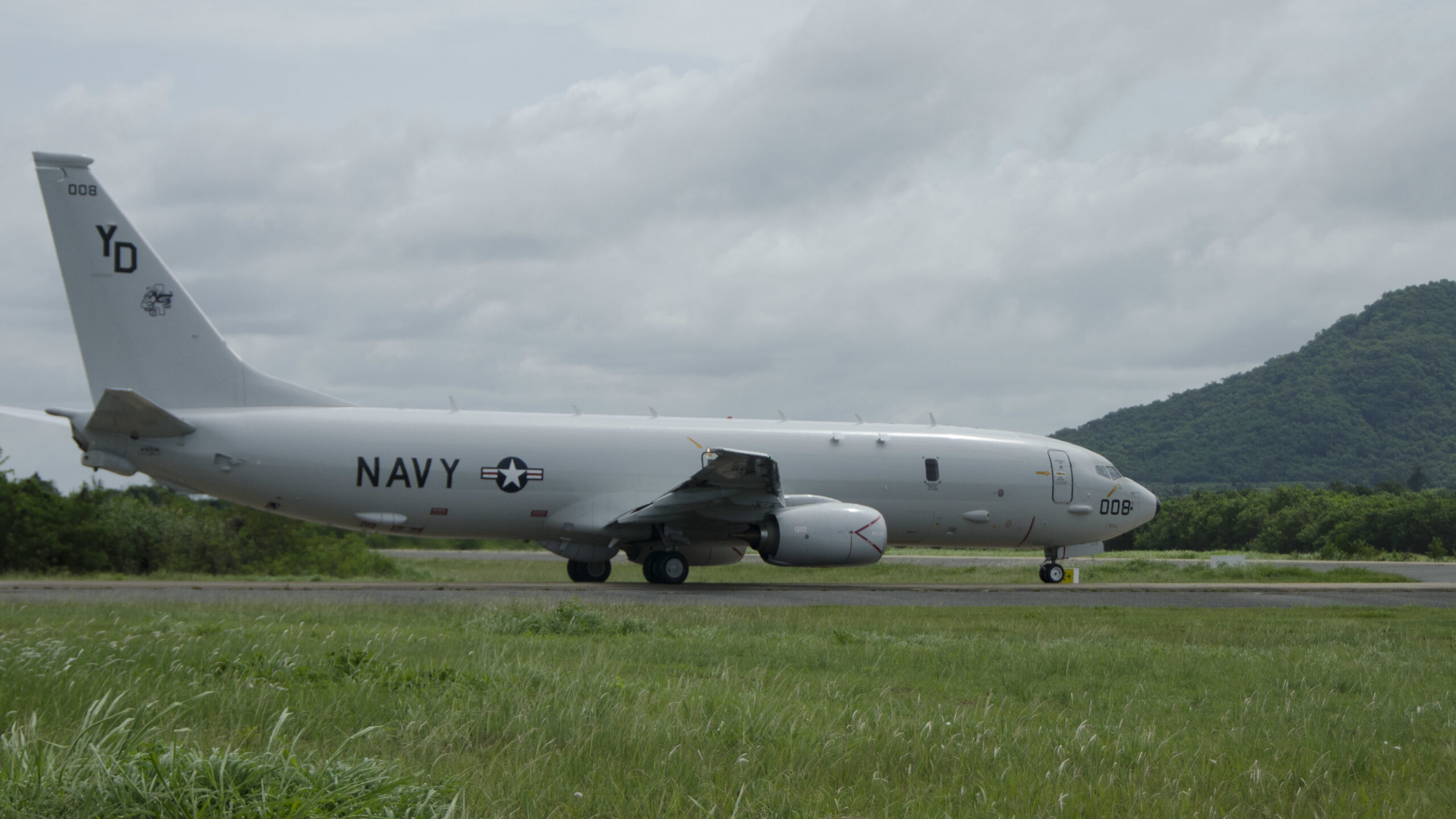
To get out into the Atlantic, the Russian submarines need to pass through the Barents Sea, north of Finnmark. This sea area is relatively shallow, with an average depth of approximately 230 m (750 ft), and detecting submarines here is quite simple. Monitoring these sea areas and hunting for submarines has been a priority task for Norwegian defence ever since the Second World War, and reports on Russian submarine movements in the Barents Sea have been among Norway’s most important contributions to the NATO community. When Norway recently procured five new P-8A Poseidon surveillance aircraft, this was done precisely to boost Norway’s submarine hunting capabilities in the sea North of Finnmark.
Oil, Gas, Fish, and Sanctions
As the Barents Sea appears to be becoming an ever more important area for the Russian navy, this is also an arena of ever-increasing economic importance. Throughout history, there have always been significant fish resources in these areas, and in the time after the Second World War, the Norwegian and Russian authorities have always managed to cooperate on fishing quotas and management of the fishery resources.
However, the sanctions that have recently been invoked against Russia create problems and new challenges for the Norwegian fishing industry and the Norwegian authorities. Norway has toed the EU line and introduced the same sanctions package against Russia as other EU countries. The sanctions mean that, among other things, that Russian vessels are not allowed to go into port in EU countries or in Norway. Yet the Norwegian government has made one exception, whereby Russian fishing vessels can go to Norwegian ports to deliver fish. This exception has met with massive criticism from the political opposition, who claimed that Russian sales of fish in Norway go “directly to finance the war against Ukraine”. However, the Norwegian government defends Norwegian policy by pointing to its obligation to cooperate with Russia in the Barents Sea as well as the need to manage common fish resources in the North. There is also no doubt that sourcing raw material for the Norwegian fish processing companies along the coast is an important consideration for the government. A similar situation may also become relevant when it comes to oil and gas resources in the North.
In 2011, after more than 40 years of negotiations, the so-called dividing line agreement was concluded, an agreement that clarifies the border relationship between Norway and Russia in the Barents Sea. However, the agreement also contains provisions for cooperation on the exploitation of possible trans-border petroleum resources under these sea areas. As of today, no discoveries of viable oil or gas deposits have been made in these areas. But if major oil or gas fields were to be discovered in the areas adjoining the dividing line in the East, it would entail significant challenges with respect to the dividing line agreement provisions on cooperation with Russia, and the sanctions package that the EU and Norway have adopted. At the same time, the EU is pressuring Norway to increase Norway’s gas supplies to Europe when Russia shut down its gas pipelines.
Up until the Russian invasion of Ukraine, Norway supplied approximately 21 per cent of the EU’s gas imports. Russia supplied around 43 per cent, and although Norway has increased its production somewhat during the year, it goes without saying that Norway will not come close to replacing the loss of Russian gas in the short term. In the longer term, Norway will probably be able to contribute more to making the EU’s gas supply less dependent on Russia, but this will call for new gas fields to be discovered and developed in the Norwegian sea areas. In this respect, the Barents Sea will again be a key area. Norwegian authorities estimate that more than 50 per cent of Norway’s as yet undiscovered gas and oil resources lie just in the Barents Sea. If this turns out to be correct, there is a future risk that large parts of the EU will become dependent on gas from a sea area that lies right up against Russia’s border, and which is the “shipping route” out into the Atlantic for the Russian Northern Fleet.
Today, one can today only speculate about what challenges this will entail, both when it comes to developing the petroleum business in these areas, or securing, and at worst protecting, the supply of gas to Europe from the Barents Sea. In any case, the development of these hydrocarbon resources to the extent that they can cover most of Europe’s gas needs, will lie many years in the future.




![Ukraine and the Western Balkans – from parallel pasts to a shared future Participants at the fourth Ukraine-Southeast Europe summit gathered in Odesa on 11 June 2025. [Office of the President of Ukraine]](https://euro-sd.com/wp-content/uploads/2025/07/Odesa-summit-2025_Office-of-the-President-of-Ukraine-Kopie-218x150.jpg)
![Connect-4 The European Super RAP developed by NATO’s ACCS is shared with NATO’s Allied Air Command headquarters in Ramstein, western Germany. Two CAOCS, controlling NATO airspace above northern and southern Europe, generate these RAPs. [NATO]](https://euro-sd.com/wp-content/uploads/2025/06/NATO-Allied-Air-Command-NATO-Kopie-218x150.jpg)
