
Ground surveillance consistently monitors ground activities and has historically relied on radar and observational data. This integration of multiple pieces of equipment, such as cameras, radars, and other electronic sensors, results in a single-band or multi-spectral surveillance coverage over a specified area. Unlike conventional systems relying on single sensor feeds inspected by human operators, persistent surveillance enables continuous monitoring by automated means, acting as an ‘unblinking eye.’ Constantly analysing the sensor feeds, these systems may prevent incidents by early threat detection and even pre-empt potential issues, enabling a swift and timely response.
Digital imagery has revolutionised persistent ground surveillance, introducing significant technological advantages. Unlike traditional methods, modern systems mostly automate operations and can perform constant surveillance without fatigue or attention lapses. These systems cover large areas, including harsh or inaccessible terrain, delivering real-time information to their operators. They automatically detect and track suspicious objects within predefined areas or by analysing the object’s activity. Video processing can be done on the camera or at the command centre. Depending on the activity of a detected target, these systems trigger an alert through rule-based or behaviour analysis that can be learned automatically over time.
The early 2000s saw the development of persistent ground surveillance technology. They played a major role in the US-led ‘Global War on Terror,’ operating as part of force protection packages on aircraft, aerostats, and unmanned aerial vehicles (UAVs) used by coalition forces in Afghanistan and Iraq. The Israel Defense Forces (IDF) also have utilised these capabilities to secure Israeli borders. Today, persistent surveillance capabilities are already introduced in some ‘safe city’ programmes despite public concern about the privacy issues they create. This article addresses the technological aspect of persistent surveillance but does not delve into the public debate about the legality of the civilian use of those systems.

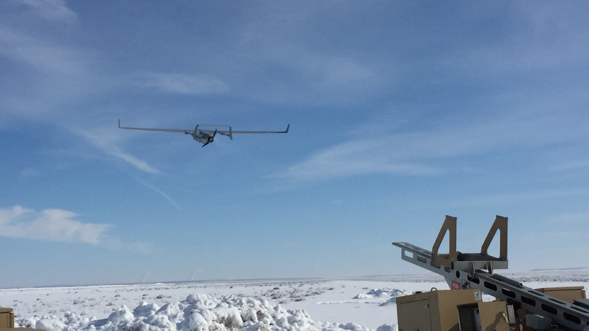
Credit: USAF/Tech. Sgt. Robert Cloys
A crucial feature of these systems is their ability to integrate live and archived data from various sources. Collecting and analysing data from multiple sources, such as thermal cameras, radar systems, acoustic sensors, and satellite imagery, provides a holistic picture of the surveillance area and deep insight into perpetrators’ potential hostile activities and preparations. This allows for more accurate detection and response. These capabilities are further enhanced by advanced video motion analysis algorithms, artificial intelligence (AI), and machine learning (ML). They allow the system to identify patterns, detect anomalies, and predict potential threats.
Persistent ground surveillance utilises various sensors and software tools to gather information and continually monitor vast areas of interest. Each tool offers unique capabilities, from the optronic sensors’ passive surveillance and high-resolution imagery to the all-seeing Gorgon Stare Systems’ real-time wide-area motion imagery (WAMI) and Multi-INT payloads.
Wide-Area Motion Imagery
Optronic sensors operating in visible (VIS) and near-infrared (NIR) wavebands, are extensively employed by military and security forces for intelligence, surveillance, and reconnaissance (ISR). These sensors act passively, though some utilise infrared light to actively illuminate the scene. Certain active systems deploy pairs of infrared (IR) sources and sensors, functioning as ‘optical tripwires’ that prompt action when their line of sight is disrupted. There is also the and short-wave infrared (SWIR) band, which is particularly good at highlighting muzzle flashes and is thus employed in hostile fire indicator applications.
Traditional cameras demanded constant human monitoring, however, newer automated systems now leverage real-time image processing technologies, such as video motion detection and object recognition algorithms that can automatically trigger alerts, transforming the operator’s role from monitor to analyst. Modern wide-area optronic payloads are explicitly designed to blanket extensive areas with high-resolution imagery, facilitating the identification of individuals, vehicles, and other objects without human monitoring.
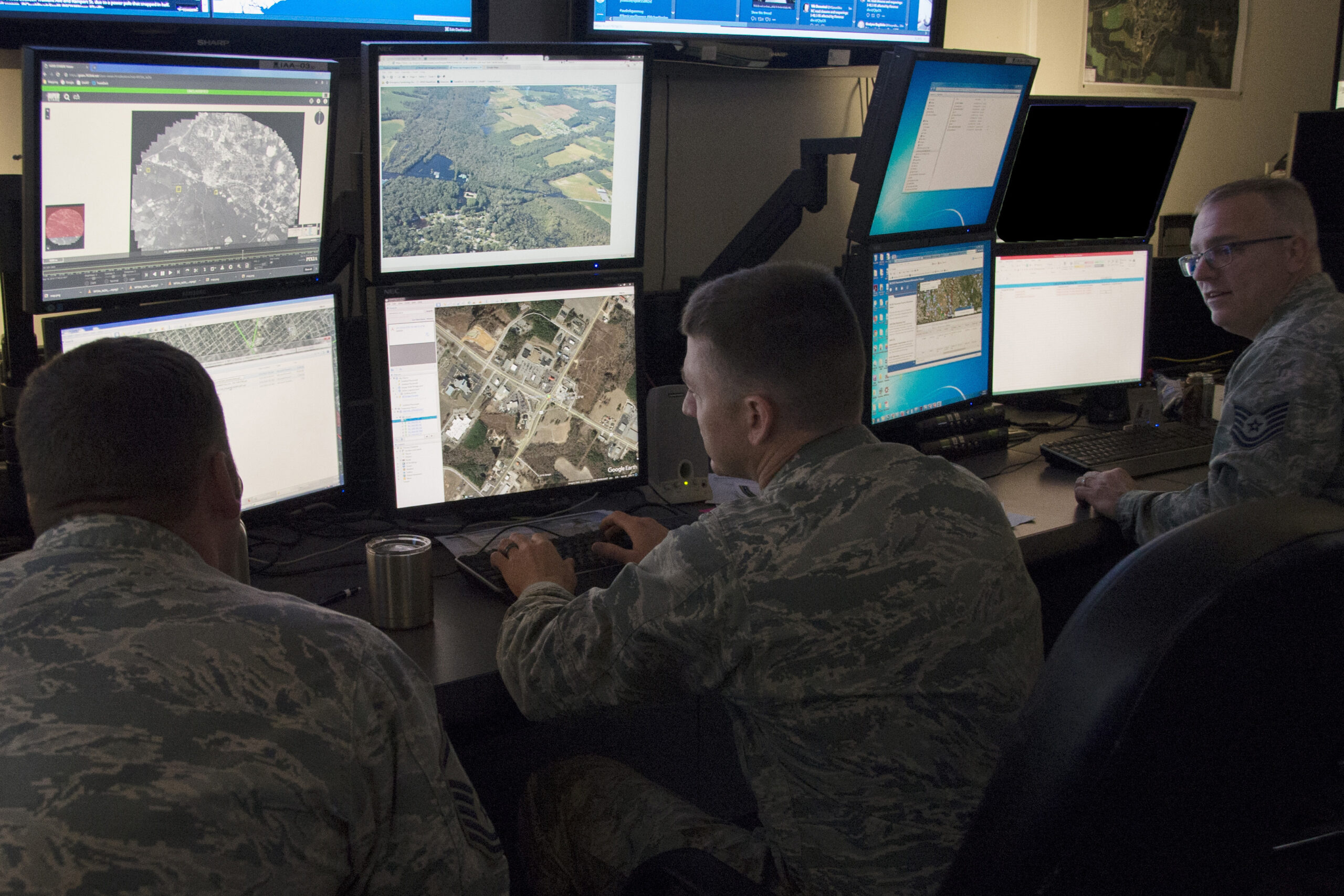
Credit: Logos
The US-based company Logos offers a compact wide-area motion imagery (WAMI) payload called Redkite-1, designed explicitly for the Insitu RQ-21 Integrator Group III Tactical UAV. The company also developed the Blackkite-1 pod to accompany the Redkite-1 missions at night. The company extends similar capabilities with its Redkite pod system, which is adaptable for light aircraft or helicopters. This compact system can conduct surveillance of an area equivalent to a small city in near real-time. Its coverage, defined by a circular footprint with a 4 km radius, allows for detecting and tracking multiple targets simultaneously, recording events for subsequent analysis. The system’s resolution is tuned to track vehicles and spot moving dismounts within user-designated ‘watch boxes’ thus enabling automated detection alerts. Redkite-1 employs the Multi-Modal Edge Processor (MMEP), a high-performance processor that transforms gigabytes of data into geotagged imagery, storing up to eight hours of mission data on the platform. This data can be shared with friendly forces while the sensor is airborne over the scene. Ground operators can also use the WAMI system’s live and previously-recorded geotagged imagery for intelligence collection and analysis.
3D Mapping Cameras
High-resolution geotagged imagery can be transformed into 3D models, delivering near-real-time information to users and enhancing situational awareness and operational planning. Earlier this year, the Israeli firm BlueBird Aero Systems unveiled the MagiCam, a high-resolution 3D wide-area mapping camera. When deployed on a small drone flying 500 m above ground, it can cover up to 40 km2/hour in 2D or up to 12 km2/hour in 3D. This 1.5 kg camera payload incorporates a 103 MP sensor and an onboard processing computer processing the imagery. With a Ground Sample Distance (GSD) of 3.2cm/pixel, the system generates crisp and detailed images, which can be transformed into actionable intelligence in 3D models, maps, or orthophotos within hours of landing. To compile the data necessary for mapping, MagiCam scans the area, capturing many geotagged, high-resolution images in all directions to ensure precise 3D mapping. The system also processes IR thermal mapping to enrich the model by spotlighting changes in the object’s heat signatures indicative of recent human activity.
Through scanning, MagiCam can detect and mark disparities between current and previous sorties, enabling users to track changes in ground surfaces, object dimensions, textures, and more. This information can be vital in identifying potential threats, such as Improvised Explosive Devices (IEDs) or mines, as well as pre-prepared ambush sites.
Harnessing Thermal Vision
Optronic thermal imagers are passive devices that transform the infrared radiation emitted by objects into discernible images. Operating in two distinct bands — mid-wave (MWIR), and long-wave IR (LWIR) — these sensors prove especially effective in low-light or night-time scenarios. They excel in detecting heat signatures such as those emitted from a human body or vehicle movement, even without visible light. Both excel at penetrating environmental obscurants such as haze, fog, and rain, with MWIR slightly more suited to warm climates, and LWIR more conducive to colder climates.

Credit: Elbit Systems
Most thermal imagers are engineered to detect and identify targets at extended ranges, but they need to encompass a broad area for persistent surveillance. Elbit Systems’ SupervisIR is specifically designed for this application. It furnishes automatic target detection and tracking with a panoramic field of view spanning 12.5° in elevation by 90° in azimuth. The system automatically detects and tracks multiple targets and displays them in multiple windows specified by the operator to show specific areas of interest. This sensor can function independently or as part of an integrated system, guiding other sensors to observe, identify, and engage targets.
Elbit Systems has also developed an airborne surveillance payload for tactical UAVs, such as the SkyLark 3. Known as MiniSkEye, the system provides day and night persistent surveillance over a wide area. Data and video obtained by the WAMI optronic IR sensor are stored onboard, offering user access via standard interfaces and communication channels in real-time. The system executes WAMI for persistent surveillance or sweeps through a ‘push-broom’ style aerial survey to cover larger areas, leveraging historical data to detect changes in the currently surveyed scene. With WAMI, the system offers an overview of the entire area, automatically detecting activity and movement in multiple user-defined zones.
Images are captured at high resolution, enabling the system to perform target recognition automatically. At the same time, analysts or users can further analyse the target behaviour using one of the system’s many high-resolution windows. Although the system primarily uses thermal imagery, it can cross-cue with other cameras onboard the host platform to automatically track operator-specified targets with full-motion video when necessary.
The Unblinking Eye
In response to a pressing US DOD demand for real-time, wide-area surveillance capabilities during the early 2000s, US-based Sierra Nevada Corporation (SNC) conceived the Gorgon Stare (GS). This transformative technology has drastically expedited intelligence preparation for combat operations from days to hours and minutes on a single mission. GS has been extensively used, so far accumulating over 100,000 flight hours.
The system uses an array of 12 cameras to provide uninterrupted surveillance over a city-sized area, round-the-clock. It leverages day and thermal channels, which can be streamed to users in near real-time to offer overwatch footage while simultaneously being archived for further use. An essential feature of the system is this post-mission review of the recorded motion imagery, which allows for forensic analysis following an incident or another significant activity.
Credit: US DoD
Over two decades of operations have seen the Gorgon Stare system evolve significantly. The latest iteration, Gorgon Stare Increment 2, provides more versatile area coverage, improved resolution sensors, and the addition of a broadband Beyond Line-Of-Sight (BLOS) communications data link capable of supporting up to 40 Mbps data backhaul over SATCOM, LINK 16, and MESH networking. The size and weight reduction have enabled SNC to incorporate both sensors into a single pod, allowing the MQ-9 to carry weapons alongside the Gorgon Stare ISR package.Further enhancements include adding day colour imagery, dynamic camera aiming, and adaptable flight pattern manipulation, enabling operators to contract or expand the data collection area while keeping the aircraft’s flight path within permissive airspace. In addition to increasing the frame rate and sensor resolution for enhanced image clarity and object characterisation, Gorgon Stare has introduced artificial intelligence (AI) capabilities. This allows for automated target detection, classification, and tracking based on various parameters such as geography and behaviour.
Ground Surveillance Radars
Surveillance radars are crucial in monitoring expansive areas for moving objects on the ground and in the air. Unlike their counterparts employed for airspace surveillance, which often provide 360° coverage, ground surveillance radars are typically static and focus on specific sectors. These systems offer insights into tracked targets’ position, velocity, and direction. Modern radars, leveraging electronic scanning, are more compact and lightweight than their predecessors.
For instance, the ELM-2112 V8 radar by IAI Elta is a compelling example. It can detect a person walking at a distance of up to 6.5 km or a vehicle up to 13 km away, ascertaining their range with an accuracy of 3 m. Weighing just 9 kg and equipped with batteries supporting up to 36 hours of operation, this portable unit can be carried in a backpack, mounted on a vehicle’s telescopic mast, or deployed on an aerostat. Additionally, the system can be integrated with other sensors, such as observation equipment, launch detection systems, or communication systems, empowering users to monitor areas even without a line of sight.
Credit: SRC Inc.
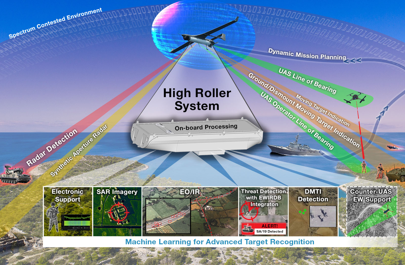
Another type of airborne radar is the Synthetic Aperture Radar (SAR) and Ground Moving Target Indicator (GMTI), which provides WAMI-like imagery in all weather conditions. Such radars are often mounted on UAVs, and in this vein High Roller was conceived as a multi-intelligence payload for the RQ-21 Integrator. The payload reconciles signals of interest (SOI), synthetic aperture radar (SAR), electro-optical/infrared (EO/IR) imagery, and moving target indicators (MTI). Besides delivering independent streams of ISR data, High Roller enables the host platform’s onboard systems to collaborate autonomously, offering multiple-look, geo-registered multi-INT data to friendly forces on the ground.
Surveillance by Signals Intelligence (SIGINT)
Monitoring signals of interest across the radio frequency (RF) spectrum yields real-time intelligence from radio emissions of various sources, including mobile phones, radios, radars, and drones. Comprehensive solutions such as the RFEye from the US-based CRFS company are combined with radar and electro-optical systems, integrating seamlessly into the persistent surveillance mechanisms of aerostats for tasks such as border protection or safeguarding strategic locations.
The unique advantage of these SIGINT systems is the localisation of each signal, which enriches the situational picture by adding more layers of intelligence. These systems meticulously exploit the signals, classifying and geolocating their sources. This information can guide other sensors toward these locations for a more detailed investigation. An in-depth examination of operations, interactions, and shifts in behaviour patterns of these signals could hint at the activity and intentions of the targets. Thus, SIGINT systems are instrumental in detecting and understanding potential threats.
Unlocking the Power of AI
While individual sensors are responsible for collecting video feeds and data, the potent digital processing capabilities using cutting-edge pattern recognition and motion analysis algorithms deliver the analytic processing power. This power enables activities such as triggering rule-based alerts for analysts to study, performing target recognition, tracking targets, and providing comprehensive situational awareness, adding recommended actionable courses for operators, commanders, and forces. These systems are also invaluable for security organisations overseeing large public events, maritime surveillance operations, and military forces. Tapping endless information sources and data points, analytic AI-driven systems can expand the area under surveillance far beyond the visible area covered by the sensors.
One such example of technology deployment is the Halo Drone and Stream technology, used at recent major sporting and cultural events to monitor protester activity, persons of interest, ticket reselling, and crowd safety. The live streaming capability of the Halo (v5) incident and threat management system significantly enhances its utility and provides an important link for building intelligence.

Credit: Halo Solutions
IAI’s Elta StarLight system is another significant player in this space, primarily used for military and maritime security. This cloud-based multi-INT analysis system transforms massive amounts of unstructured data from distributed ISR sensors into actionable intelligence. The sensor-agnostic system interfaces with SAR/GMTI radars, SIGINT, EO/IR, Video, WAMI, and Launch Detection Systems. Its innovative AI-based smart operational applications include a situational awareness engine, data mining tools, a threat generator, and more, all interacting to interpret and understand the tactical situation picture and implement responses most efficiently.
Palantir’s AIP is another solution leveraging AI to process intelligence data used by all US DOD branches. Currently supporting the Ukrainian Army in its conflict with Russia, this multi-INT system taps thousands of intelligence sources of all modalities, providing alerts on enemy movements, preparations, or potential opportunities on the battlefield. Using AI to analyse the sensor data, analysts can swiftly answer crucial questions such as the enemy’s location and intentions. NATO analysts use these procedures to locate Russian troop concentrations, air defence systems, command posts, and supply depots across the war zone. Following the detection and designation of targets for attack, they are transferred directly to the Ukrainian forces over commercial broadband satellite links.
In summary, integrating AI technology is evolving surveillance and reconnaissance operations in both civilian and military contexts. Collecting, processing, and analysing vast amounts of data in real-time enhances situational awareness and enables proactive responses to potential threats. The increasingly sophisticated use of AI, particularly in predictive analytics, signifies a new era in intelligence and security operations.
Tamir Eshel


