Inertial Labs, a global provider of inertial sensors and integrated GPS systems, recently announced that its lidar-based Remote Sensing Payload Instrument (RESEPI) solution has been integrated into the high-performance unmanned aerial vehicles (UAVs) manufactured by ideaForge.
The collaboration, Inertial Labs asserted in a press release, “marks a significant advancement in UAV-based lidar mapping, providing industries with an enhanced, highly accurate and reliable solution”.
As well as for the defence sector, the solution also has applications in sectors such as mining, forestry, GIS and land surveys, and water resource management.
The UAVs produced by ideaForge, which are mostly quadcopters, have been designed to be able to handle a wide variety of terrain and temperature conditions.
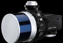
Inertial Labs’ range of lidar-based RESEPI payloads range from 0.9 kg for the RESEPI Livox AVIA (without camera) to 4.3 kg for the RESEPI Teledyne CL-360HD (with camera). The recommended altitudes from which they should be operated rnage from up to 85 m for the RESEPI Livox AVIA to up to 200 m for the RESEPI Teledyne CL-360HD.

“We are thrilled to partner with ideaForge to offer this enhanced lidar solution,” Jamie Marraccin, CEO at Inertial Labs, was quoted as saying in a company press release. “The integration allows us to provide a superior product that meets the high standards of accuracy and reliability demanded by various industries, taking UAV-based lidar mapping to the next level.”


