


Since the 1980s, many nations have relied on the Global Positioning System (GPS) for position-finding, missile guidance, and for the precision timing that is essential for many military and civil high-technology systems. So inevitably, this has resulted in the development of corresponding countermeasures.
In 2003, Iraq deployed GPS jammers (probably of Russian origin) in the hope of disrupting the functioning of the US-led coalition’s satellite-guided munitions. All six jammers were located and destroyed – in one case by a GPS-guided weapon. Yet the following two decades of development have created jammers of much greater effectiveness.
When first used by Ukraine in the first half of 2023, the GPS-guided BAE Systems/Raytheon M982 Excalibur 155 mm artillery shell was credited with high accuracy, as were other GPS-guided weapons in Ukrainian service, such as the Lockheed Martin M142 High Mobility Artillery Rocket System (HIMARS). Local press reports claimed that Excalibur rounds typically landed not more than 4 m from their planned aimpoint. This success proved short-lived; by August of that year Russian jamming had blunted the effectiveness of Ukraine’s GPS-guided weapons.
The GPS constellation
Currently the GPS constellation consists of 31 operational satellites – six Block IIR launched between 1997 and 2004, seven Block IIR-M launched between 2005 and 2009, 12 Block IIF launched between 2010 and 2016, and six GPS-III launched from 2018 onwards. All but the Block IIR transmit M-code. This uses a different waveform with a broader radio frequency range, transmitted at higher power, features that provide greater resistance to jamming. Compared to its predecessors, it also incorporates enhanced signal encryption intended to make spoofing more difficult.
Many of these satellites have exceeded their design lifetime. The oldest Block IIR satellites have exceeded theirs by more than 20 years, with the oldest Block IIR-M more than a decade past their planned lifetime, and the oldest Block IIF are two years past theirs. By these standards, the six GPS-III are comparative youngsters, having been designed for a 15-year lifespan. Production of the first two Block IIIF satellites is now under way, and the first is due to be orbited in 2027. A further eight are under contract, and 12 more are planned.

Despite the advantages of M-code, progress in developing receivers able to exploit it has been slow. According to the US Government Accountability Office (GAO), approximately 700 different types of weapon systems, including aircraft, ground vehicles, and ships, will require M-code-capable user equipment. However, in a September 2024 report it noted that as a result of what it described as years of delay, the first increment of user equipment able to use M-code signals is only now approaching its final series of tests, but the report warned that “discovery of additional deficiencies threatens the program’s schedule”.
Jamming and spoofing
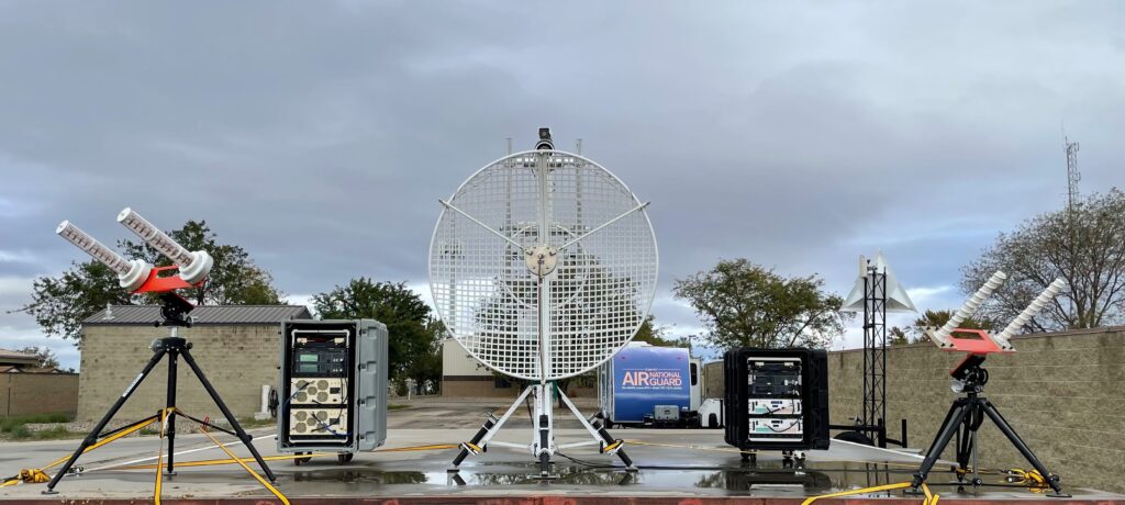
GPS signals are easy to jam due to their very low power when they reach the Earth’s surface. Jamming is fairly easy to detect, but GPS spoofing is a more subtle threat. It involves mimicking the GPS signal in order to make GPS receivers lock on to the signals generated from the spoofing device rather than the authentic GPS satellite signals, causing them to provide false positional and/or time information.
Military-grade GPS receivers are resistant to many forms of spoofing because the (P)Y-code and M-code signals from the satellite constellation are encrypted. However, if an enemy is unable to duplicate this encryption process, spoofing can still be attempted by rebroadcasting a time-delayed copy of the genuine signal without decrypting or altering the data in order to mislead GPS receivers and cause them to generate false location data.
The problems posed by spoofing were well-known even two decades ago, and prompted several potential countermeasures. The strength and elevation angle of the signal being received are two factors that may betray the presence of a spoofing signal. This may not successfully mimic features of the real signal such as changes in signal strength as the receiver changes from receiving from one satellite to receiving from another.
Incidents of global navigation satellite system (GNSS) jamming and spoofing are happening with increasing frequency. The travels of Russian president Vladimir Putin often result in GPS becoming unreliable in the area he is visiting, but less-publicised GPS outages are becoming commonplace. Some are reported to be caused by jamming systems being used to protect Russian oligarchs from drones.
The website gpsjam.org displays a daily map showing regions of probable GPS interference that have been derived from aircraft reports of navigation system accuracy. Most of the aircraft reporting bad GPS accuracy are flying near conflict zones where GPS jamming is known to occur, but incidents outside of conflict zones may in some cases be due to testing of military jamming systems.

Next-generation spacecraft
The NTS-3 Vanguard programme is intended to demonstrate game-changing position, navigation and timing (PNT) technologies and techniques applicable to the space, ground control and user equipment system segments. The goal of the project is to advance technologies that could mitigate deliberate interference to PNT capabilities, and to increase the system resilience of the GPS system for military, civil, and commercial users.
The spacecraft created by L3Harris Technologies is based on a Northrop Grumman ESPAStar-D spacecraft bus. Its digital on-orbit reprogrammable PNT signal generator will support legacy GPS signals, as well as advanced signals not currently being transmitted. A phased-array antenna will be used to electronically steer signals to a desired geographic region without physically moving the satellite. NTS-3 will test the CHIMERA signal authentication protocol intended to provide robust protection against GPS spoofing for civil users. Different kinds of signals, including future versions of CHIMERA will be uploadable to the satellite at any time after launch. NTS-3 was due to be placed in geosynchronous orbit in 2023, but this date has slipped, and launch is now expected in the second quarter of 2025.

According to the US Air Force (USAF), recent resilience studies have recommended an additional proliferated fleet of small GPS satellites, Under the Resilient GPS (R-GPS) programme, it plans to augment the existing GPS constellation by deploying up to 20 small satellites capable of transmitting core GPS signals.
In September 2024, the US Space Force selected Astranis, Axient, L3Harris Technologies and Sierra Space to develop concepts for smaller, more cost-effective GPS satellites based on commercial designs. The programme is intended to produce an initial batch of up to eight R-GPS satellites, with the intention of having these ready for launch by 2028. Following a planned down-select of companies for final design reviews and prototype development, one or more will be chosen to build the initial satellites.
However, the programme has attracted criticism from the US House Appropriations Defense Subcommittee, which rejected the USD 77 million initial funding request during June 2025. The subcommittee did not believe that additional satellites would significantly increase the resilience against jamming, and noted that the programme failed to address vulnerabilities in ground equipment.
Exploiting existing spacecraft
Although designed to provide high-speed internet capabilities, SpaceX’s steadily-growing constellation of more than 7,000 mass-produced Starlink small satellites in low Earth orbit (LEO) could become an alternative to GPS. The advantage of a constellation in LEO is that when a satellite’s signals reach the Earth’s surface, they can be several orders of magnitude more powerful that those from GPS. Although each satellite can serve only a specific geographic area, a constellation of thousands can provide global coverage.
Given a suitable upgrade to the satellite software, the Starlink constellation could provide an alternative to GPS. The data transmission rate from each Starlink satellite is about a thousand times that from a GPS satellite, so individual Starlink spacecraft could provide much more accurate data on their current position, information that would allow a ground-based receiver to calculate its own position with sub-metric accuracy. Since Starlink operates at microwave frequencies, ground-based receiver antennas are much more directional that those used by GPS receivers. This should make it easier to distinguish between the genuine transmission and those from enemy jamming or spoofing.
The US Department of Transportation’s Center for Automated Vehicles Research with Multimodal Assured Navigation (CARMEN) at Ohio State University has spent the last decade studying alternatives to GPS, and proposes to exploit the beacon signals transmitted by existing and planned constellations of LEO satellites. Although details of these beacon signals are not available to the public, CARMEN researchers have developed an algorithm able to decipher these.
By 2021, the team was able to use the signals from six Starlink satellites to determine ground position to an accuracy of 10 m. In a 2023 paper for the IEEE/ION Position, Location and Navigation Symposium they described a receiver able to exploit any LEO satellite constellation, and reported tests using Iridium NEXT, OneWeb, Orbcomm, and Starlink satellites. When trialled aboard a moving car, the receiver was able to able to determine its location to within just under 5 m.
Iridium’s PNT Division (formerly known as Satelles) proposed a Satellite Time and Location (STL) service based on its current 66-satellite LEO constellation, while other companies have proposed alternative solutions based on constellations of PNT spacecraft planned as commercial programmes. For example, US company TrustPoint is developing a commercial GNSS. Intended for civil and military use, this will exploit the company’s planned C-Band LEO satellite constellation. The first technology-demonstration satellite was launched on 15 April 2023, and further satellites are due to be launched by the end of 2025.
In February 2025, Xona Space Systems announced that it had been awarded a USD 4.6 million contract from the Air Force Research Laboratory (AFRL) to demonstrate its planned constellation of Pulsar LEO satellites, the first of which is due to be launched in June 2025. Further launches planned for 2026 are expected to allow initial operational services in 2027. A total of 258 satellites is expected to form the definitive constellation. Other companies are also planning satellite constellations. If fully deployed, these commercial ventures would require a potential enemy to develop and field suitable jamming or spoofing capabilities, but it remains to be seen how many will prove commercially viable and be fully deployed.
Russia makes no secret of the fact that it possesses anti-satellite (ASAT) capabilities, which it demonstrated on 5 November 2021 by using an A-235 PL-19 Nudol missile to attack and destroy an obsolete Soviet-era Tselina-D SIGINT satellite. Several days after the interception, and only three months before Russia’s full-scale invasion of Ukraine, Russian state TV claimed that ASAT missiles could destroy all 32 satellites in the GPS constellation. However, if future satellite-based navaids used hundreds or even thousands of satellite such as the Starlink constellation, most physical attacks on such a large number of spacecraft would be totally impractical.

Possible alternatives to GPS
In November 2023, the USAF released a SBIR (Small Business Innovation Research) solicitation, asking industry to propose “alternative, GPS-independent, navigation augmentation sources of positioning, navigation, and timing (PNT) data for the warfighter, civil and commercial user”. These sources could augment GPS or to act as a short/medium-term alternative to GPS if access to the latter is degraded or denied.
Potential solutions listed included “non-GPS space-based RF [radio frequency] systems including global navigation satellite systems (GNSS), self-contained inertial navigation systems (INS), celestial navigation, computer vision-based approaches, network-based timing approaches, PNT-over-communications, signals of opportunity, and other land-based RF augmentation systems”.
Other recent commercial efforts of potential interest mentioned in the SBIR included “low cost proliferated LEO (pLEO) communication mega-constellations… machine learning and artificial intelligence, quantum sensing, low cost high data-rate space laser crosslink networks, chip scale atomic clocks, very high density reconfigurable field programmable gate arrays, Graphical Processing Units, as well as the convergence of satellite communications and 5G/6G cell networks.”
Following a planned Phase I study and analysis phase, Phase II was expected to involve contracts intended to provide “an end-to-end capability demonstration in a relevant laboratory operational environment, including initial field testing to prove that the proposed Alt-PNT capability is prepared to move in to limited production and limited operational field testing.” Under a Phase-III anticipated for FY2026 or even earlier, the most promising solutions are expected to transition to limited low-rate production of sufficient sub-systems to allow limited operational demonstration in operational environments.
A Government Accountability Office (GAO) report published in August 2022 noted that while the Department of Defense (DoD) was introducing the M-code and technologies such as anti-jam antennas, it warned that “even with these upgrades, vulnerabilities will remain”.
INSs use sensors such as gyroscopes and accelerometers to track a system’s current location from a known starting point. Although small, the inevitable errors in measurement accumulate over time, and gradually degrade the system’s positioning accuracy. Combining information from a GPS receiver with that from an inertial measurement unit (IMU) creates a system that combines the short-term accuracy of an INS with the long-term accuracy of an unjammed satellite navigation (SATNAV) receiver. However, the usefulness of such a combination depends on not having long periods of SATNAV outage.
The August 2022 report was a public version of a report that the GAO had issued in April of that year. The latter had contained information that the DoD deemed to be sensitive, and should be protected from public disclosure. As a result, the August version omitted what the GAO described as “sensitive details about seven of the 11 alternative PNT technology and product development efforts we identified”. While little is known about some of these projects, in other cases some information is available.
One project cited by the GAO in its August 2022 report is the US Army’s Mounted Assured Positioning, Navigation and Timing System (MAPS), a vehicle-mounted system intended to integrate data from an M-code capable GPS receiver, a receiver for a commercial space-based satellite system (ALTNAV), an inertial sensor, and a high-accuracy clock. A similar array of sources forms the basis of the Dismounted Assured Position Navigation and Timing System (DAPS) intended for use by soldiers on foot.

US Navy (USN) surface ships and submarines use GPS-derived positioning data for navigation, safety at sea, and for weapon guidance. The Navy is updating its GPS-based PNT capability by combining a GPS M-code receiver, precision clock, a receiver for time information from satellites, and automated celestial navigation.
Almost every USN ship currently uses the Northrop Grumman AN/WSN-7 INS. In June 2022, the service awarded Northrop Grumman a production contract for the AN/WSN-12 Inertial Sensor Module (ISM), a key component in the new AN/WSN-12, a replacement system that will occupy the same footprint as its predecessor. The ISM in intended to provide highly accurate positioning data with or without the use of GPS.
The Automated Celestial Navigation System (ACNS) is intended to allow USN operations in a GPS-denied environment by continuously determining a ship’s position, and providing data that can be displayed in a ship’s pilothouse, or fed directly into the ship’s INS. A hardware prototype was developed under a programme begun two decades ago. This involved the design and manufacture of a single-aperture sensor mounted on an equatorial astronomical mount intended to measure the star limiting magnitude and probability of detecting stars, along with a multi-aperture strap down sensor system able to view three areas of the sky separated by 120° in azimuth using a single focal plane array. This hardware is intended to operate by day or by night. The final configuration is expected to consist of an above-deck sensor used to gather celestial data, and a fibre-optic cable that connects this to a Below Deck Unit (BDU) being integrated into Rack 1 of the ship’s GPS-based Positioning, Navigation and Timing Service (GPNTS).
The USAF is developing a Resilient-Embedded Global Positioning System/Inertial Navigation System (R-EGI), which will combine an inertial sensor and a GPS M-code receiver, and be compatible with future alternative PNT capabilities. Under current plans, this will initially be fielded on its F-16 fleet.
The magnetic solution
The largest component of the Earth’s magnetic field is termed the Core Field, which is responsible for the ability of a compass to point towards the magnetic North Pole. While the Core Field displays very little spatial variation, a second significant component known as the lithospheric or crustal anomaly field is mappable, making it a candidate for use as an aid to navigation. Multiple flight tests have proven the concept, and early sorties conducted at low level demonstrated accuracies of tens of metres over time-scales of hours.
Magnetic navigation is passive, and does not require its host platform to emit any form of signal. Since an unrealistically large amount of energy would be needed in order to create local disruption of the crustal anomaly field, a magnetic navigation system would be unjammable. Additionally, since it has no attackable infrastructure, it cannot be put out of action by an enemy.

Visual-aided INS
One possible alternative method of providing an INS with accurate positional data is to use optoelectronic sensors such as cameras and Lidar to observe nearby terrain, and compare the gathered data with a stored digital map generated by sources such as satellites or photo-reconnaissance air vehicles. This technique can involve exploiting the whole of the imagery, or by observing specific features of the scene. Terrain features such as buildings can be used as reference points, allowing the IMU-derived position to be corrected at regular intervals.
One problem with this concept is the amount of high-resolution terrain data that is needed, and the computationally-expensive algorithms required by the process of comparing this with the terrain imagery being observed. The UK company NILEQ has developed a navaid which uses imagery from neuromorphic cameras. These do not capture traditional imagery, but record changes in brightness across the sensor’s individual pixels. This technique generates much less data than that created by a conventional camera.
Proprietary algorithms developed by the company use this data to create a terrain fingerprint of the tactical area, which is then compared with a stored database of terrain fingerprints that have been generated from satellite imagery. According to the company, terrain fingerprints contain much less data than a conventional terrain database, and the process of comparison requires dramatically less computation.

The US Air Force Life Cycle Management Center (AFLCMC) Positioning, Navigation, and Timing (PNT) Program Office and Integrated Solutions for Systems (IS4S), working in collaboration with AEVEX Aerospace completed a series of six flight tests of a Resilient-Embedded GPS/INS (R-EGI) Modular Open Systems Architecture (MOSA) in early 2025. These flight tests began aboard a Special Operations Command (SOCOM) C-146A Cougar aircraft three weeks after AEVEX Aerospace successfully integrated its LynxVBN Vision-based Navigation System with R-EGI’s Mission Capability Navigation (MCNAV) software.
During the airborne tests, R-EGI successfully operated in GPS-denied environments, relying on AEVEX’s vision-based updates to navigate accurately. According to IS4S, even with GPS antenna disconnected from the R-EGI GPS receiver, the combined system maintained approximately 10 m of positioning accuracy for up to 2.5 hours.
Quantum technology – a long term unjammable solution?
The position error of an INS accumulates over time and distance due to bias and drift errors inherent in the use of classical sensors. It is therefore essential to reset the indicated position at regular intervals by using an external reference, such as GPS. If inertial measurement accuracy could be increased by orders of magnitude over what is currently possible, this could allow INSs to operate as standalone navaids able to retain accuracy over long periods of time.
One promising potential solution is the creation of quantum INSs that rely on the precision and accuracy possible by measuring properties of supercool atoms. However, a quantum sensor can only operate with a sampling rate of 0.5–2.0 Hz, rather than the 300–500 Hz available from classical inertial sensors. As a result, a quantum sensor is likely to miss rapid changes in acceleration. To avoid the resulting errors, a quantum sensor can be teamed with a traditional microelectromechanical system (MEMS). A sophisticated artificial intelligence (AI) neural network based system can then be used to combine the data from both sensor systems.

The problem that researchers face is that current quantum sensors are physically large, typically the size of a domestic refrigerator. Making them practical for many military applications will require a major reduction in both size and power consumption.
In May 2024, the UK announced that a team involving BAE Systems, QinetiQ, and Infleqtion (a company working on quantum technology) had completed a series of test flights of a quantum-based navigation system aboard QinetiQ’s BAe 146 Airborne Technology Demonstrator aircraft. According to a member of the BAE Systems team, within five to ten years the hardware might have shrunk to about the size of a shoebox.
Hard-kill solutions
One potentially effective method of countering GPS jammers or spoofers whose position is known is an accurately delivered bomb, or several well-aimed artillery rounds, so it is hardly surprising that GPS jammers have been a potential target during the current conflict between Russia and Ukraine. In early May 2024, the USAF awarded a contract worth USD 23.5 million to Scientific Applications and Research Associates Inc (SARA) for add-on seekers able to be integrated into Joint Direct Attack Munition-Extended Range (JDAM-ER) glide and guidance kits, allowing the upgraded weapon to be used against ground-based GPS jammers. According to the manufacturer, the seeker can operate on the GPS LI and/or L2 frequencies, also Link 16, S-band, and what it coyly describes as “other bands of interest”.

The way ahead
Inevitably, there is no single or simple solution to the problem of fielding improved navaids. Perhaps the best analogy is the battle between radar and countermeasures. Jammers and other countermeasures have not made radar obsolete, but radars have not been improved to the point where they are invulnerable to jamming. While quantum-inertial systems may replace GPS in many applications, it seems unlikely that the technology can be shrunk in size and cost to the point that it can replace SATNAV-based systems in many front-line roles.
Doug Richardson


